Welcome to the trails of Singletrack Glacensis, To make it easier to navigate the system, we have divided it up by the towns through which the singletrack runs directly or nearby. We have marked access points, that is, places where you can leave your car and start cycling. We have added difficulty scale to help you choose the best loop for you.
Our singletracks consist of 23 loops and one two-way section. No matter where you start your adventure you will always return to the same place. The routes are marked in red and blue, when you go forward you go in the same colour, when you change colour you turn around.
Only in Brzozowie near Kudowa Zdrój the singletracks are marked differently. Brzozowie is not directly connected to the whole Glacensis singletrack system, but it is a place worth visiting..
So you can go for a day and ride one or more loops, but Singletrack Glacensis is also or above all a unique mountain bike trail. It allows you to ride the entire Kłodzko region singletrack cycle paths. The entire route from Srebrna Góra to Jagodna is approx. 260 km together with asphalt or gravel links. Decide for yourself how many days such a trip will take you. Good luck and see you on the singletrack!
Levels of difficulty on the Glacensis Singletrack (scale of 1 to 4):
1 family (recommended for families with young children), 2 very easy, 3 easy, 4 medium difficulty
LOOPS WITH ACCESS POINT FROM LANDEK ZDRÓJ
Loop Zdrój - difficulty 3
A somewhat demanding route in terms of fitness and technique, suitable for family trips. In the middle of the route it is possible to turn to the Trojak loop.
Distance / elevation – 7.1 km / 217 m
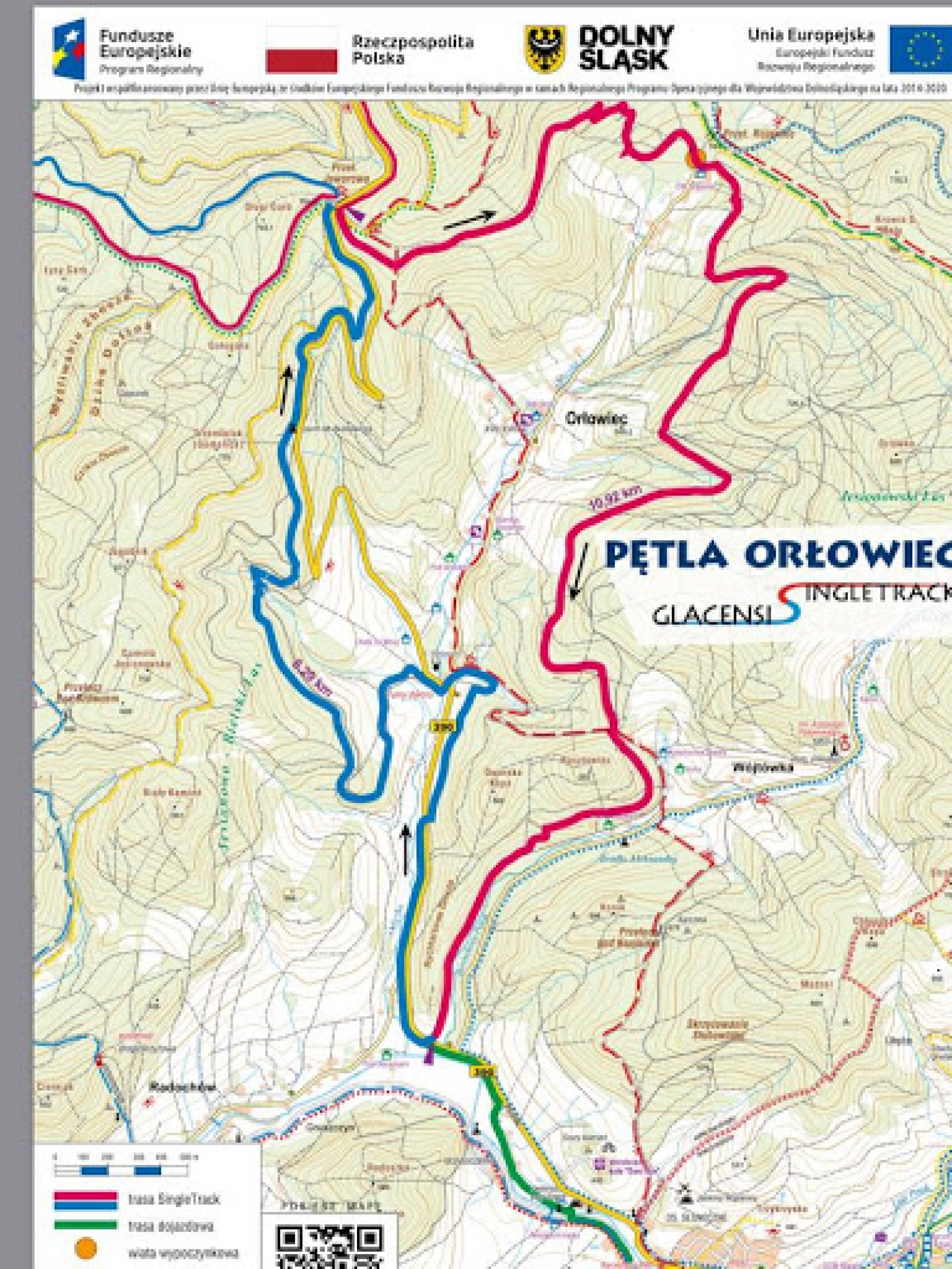
Loop Orłowiec – difficulty 3
A route that is somewhat demanding in terms of fitness and easy in technical terms.
Distance / elevation – 22.9 km / 600 m
Loop Trojak – difficulty 4
A fast flow route with technical elements - rocks and footbridges. The final 1.3 km of the climb is gravel. To get to the Trojak loop, you need to complete half of the Zdrój loop..
Distance / elevation – 6 km / 165 m
MORE INFORMATION - downloadable GPS maps.
WE INVITE YOU!